Apple country

Author: Ivan Lätti
Photographer: Thabo Maphisa
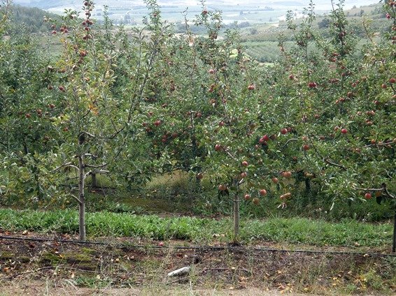
The Langkloof is a picturesque and fruitful east-west valley between the first and second mountain ranges from the coast in the west of the Eastern Cape. Famous for apple farming, other fruit also feature here, while sheep and wheat are the focus in the drier parts, mostly northerly.
The Outeniqua and Tsitsikamma Mountains lie to the south of the Langkloof. The vegetation here is fynbos, while renosterveld abounds to the north and into the Kouga Mountains. Further north lies the Baviaanskloof, the Kouga Dam to the northeast.
Some upper tributaries of the Kouga River converge in the lowlands of the Langkloof, running eastwards through the farmlands. Apart from the River, the R62 motorway also runs here, connecting George and Oudtshoorn in the west with Humansdorp and Port Elizabeth in the east.
The gradually disappearing narrow-gauge railway line of the famous apple train is the third, significant line following the Kloof from Avontuur to Port Elizabeth.
For some the Langkloof begins near Avontuur in the west where the large apple orchards start, continuing to The Heights near Twee Riviere east of Joubertina. Others may say it begins further to the west at Herold.
Around two centuries ago Lord Charles Somerset, Governor of the Cape Colony, gave a farm to someone he deemed deserving. It was called Somersets Gift, a name and a proud farm that lasted until near the end of the twentieth century. Today all of its buildings and beacons are gone, replaced by apple orchards. Progress and massive scale have arrived in this valley too; for long a quiet backwater, peaceful and rarely noticed by outsiders.
Joubertina is the main town of the region, bigger than Haarlem, Misgund, Louterwater and Krakeel. Driving through one might also notice names like Ongelegen (poorly situated) and Welgelegen (well situated).
At some of these places the apple train used to stop, the stations important venues in the lives of the local farmers. Before The Heights the upstream Kouga River turns northwards, while east of The Heights the Krom River commences and continues eastwards through the valley, never too far from the R62 to Kareedouw and Humansdorp.
The Langkloof receives 700 mm to 800 mm of rain per annum when all goes well. Inundations are not as regular as the farmers would like. Rain and drought are received here both in winter and summer... home remains home cometh the good or the bad.
Tourism features in the Langkloof. Activities include hiking, camping, mountain-biking, 4 x 4 exploration, abseiling and climbing. There is uphill and downhill everywhere!
The richly varied veld harbours succulents, bulbs, shrubs and maybe 2000 fynbos species, including interesting orchids, ericas and proteas. Some explore the caves occupied by early San or Bushman inhabitants of long ago. And the Kouga River runs through a panoramic and memorable landscape (https://showme.co.za; https://www.sa-venues.com).

